1/12/2024: For the latest on this topic, please refer to this news release.
---
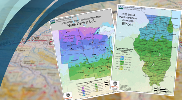
Have you seen the new USDA plant hardiness map? Have you changed zones? What does this mean? The U of I Extension is here to help you demystify the concept of zones.
What are “zones”?
When people talk about being in zone 5b or 6a they’re just giving you information about what the average coldest day is in their region. The Department of Agriculture has divided the US into 9 zones (with sub-zones). Each zone represents a 10oF spread of how cold the average coldest day of the year is. Far northwestern Illinois is 5a, while far southern Illinois is 7a. The rest of the state falls somewhere in between. So, in zone 5b, typically the coldest day of the year gets down to -10 to -15oF, while in zone 7a, it doesn’t usually get below 0. This isn’t to say that it never gets colder than that—it’s just what happens on average.
Why do average coldest days matter?
When you buy plants at the nursery, you’ve probably noticed some are labeled “perennial” and some are “annual” While there can be a few reasons for this, one is that sometimes it just gets too cold for them to survive the winter in your area. Dwarf azaleas might do fine in say, Arkansas, where they come back year after year, but in more northern climes, the winter frost can kill them. This is not an absolute rule, however. Sometimes an area has a slightly different microclimate, for example because of a brick wall providing shelter and a little warmth against those really cold days or structures that channel the wind to hammer a certain spot making it colder than surrounding areas. Or a vicious cold snap sends temps plunging for several days and kills off things that were previously doing well. Still, zones are a sort of shortcut we use when thinking of an area’s general climate and how plants will fare.
Why the change and what does it mean?
While the changes in the map have been big news, it’s not going to have wide-ranging impacts on gardeners. In fact, it actually may explain things hard-core gardeners have already seen. The main reason for the change is that scientists have been able to collect more and better data over the last few years thanks to advances in GIS and doubling the number of weather stations collecting information. This means that these maps will more accurately represent what the weather has been, rather than indicating shifts in temperatures.
So, not to worry—this change in zone doesn’t mean your favorite plants won’t survive or that you’ll have to completely re-landscape your yard if your zone has changed. But it might be an excuse to try something new that you didn’t think would grow!
And just to note, when it comes to native plants, “zone” is not really relevant. Areas of New Mexico are in the same zone as Illinois, but they grow very different plants. So keep planting the natives you know and love!
Enter your zip code to see how your zone may have changed at planthardiness.ars.usda.gov To learn more about changes from the 2012 version, go to planthardiness.ars.usda.gov/pages/map-creation
For more information on gardening, check out the University of Illinois Extension’s website at extension.illinois.edu/plants.