
Most people who read this blog know most of the symbols on a weather map, such as warm and cold fronts, high- and low-pressure areas, and stationary fronts. However, there may be one type of symbol you’ve seen and maybe even know the term for, but don’t really know what it means. That is the occluded front. This air boundary is shown as a purple line on a weather map with the pointed and rounded markings shown on one side of the line.

What makes an occluded front happen?
A typical area of low pressure, also known as a mid-latitude cyclone, has a warm front followed by a cold front.
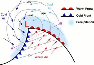
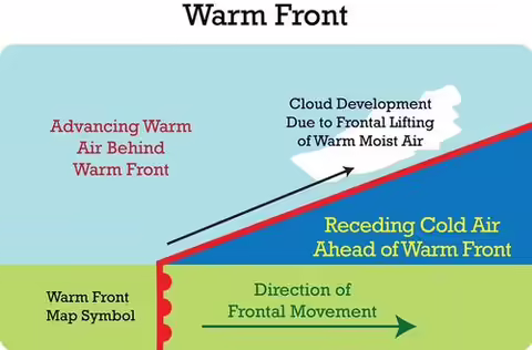
The red rounded symbols are the leading edge of warm air and is the warm front. The blue symbols are the leading edge of cold air and is the cold front. Everything between the two fronts is warmer air and is called the warm sector. The whole low-pressure area is being moved along by upper-level winds. However, on the surface, the cold front is moving faster than the warm front.
You can see that near the center of low pressure, where the L is, the cold front is very close to the warm front, so it doesn’t take long for the cold air to catch up to the warm are there. Once it does catch up, the cold air, being denser, stays on the ground, while the warm air is lifted off the ground. When the warm air is initially lifted, it may cause storms. But once the warm air is no longer rising, you have cold air near the ground where it wants to be, and warm air above where it wants to be. That means there is no longer any mechanism to continue making air rise. This takes the energy out of the system, and the mid-latitude cyclone starts to fall apart.
Here is what a mid-latitude cyclone looks like before occlusion from a side view.

Here's what it looks like after:

Mid latitude cyclones usually form, do their thing, and fall apart in about 7-10 days. New ones are constantly forming. Occluded fronts are not often mentioned in weather reports, but now you have a basic idea of what they are, how they occur, and what it may mean for weather in that area.
About the Blog
The All About Weather blog by Duane Friend explores the environment, climate, and weather topics for Illinois. Get in-depth information about things your weather app doesn't cover, from summer droughts to shifting weather patterns. Never miss a new post!