SPRINGFIELD, Ill. — Your land, your soil may have been part of an historical and extensive soil sampling program dating back to 1899 by University of Illinois. University researchers and Illinois Nutrient Research and Education Council are looking for landowners whose property was part of the original research to take new samples and understand changes that have happened in the past century.
“Our predecessors had the foresight to keep records of soil sampling locations and to store those samples at the university," says Andrew Margenot, crop sciences assistant professor. "By resampling soil from these same locations, we will gain unprecedented insight on how these soils have changed over 120 years.”
The results will enable improvements in soil fertility management and conservation, including updates to the Illinois Agronomy Handbook. The project is funded by NREC and the Illinois Farm Bureau.
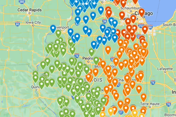
Many of the original soil sample sites, from around 450 locations, are now located on private land. Researchers are working to identify and contact landowners or producers to ask permission to sample soils. Sampling will take place with a small soil probe down 3 feet at three points within a 10- to-15 foot-area. All soil sample results will be shared at no cost and will be anonymous to protect privacy of the sampling location.
A map of the site locations is available to review. Those interested in participating, can select the a specific location to share contact information with the research team for follow up, or contact the research team directly at rothman@illinois.edu or margenot@illinois.edu. More information about the project history, goals, and process can be found on the Illinois NREC website.
This article was originally released by NREC on February 15 and written by Julie Hewitt.