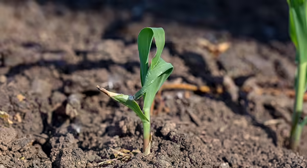
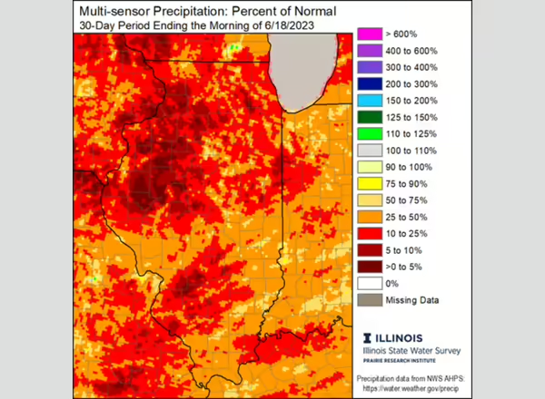
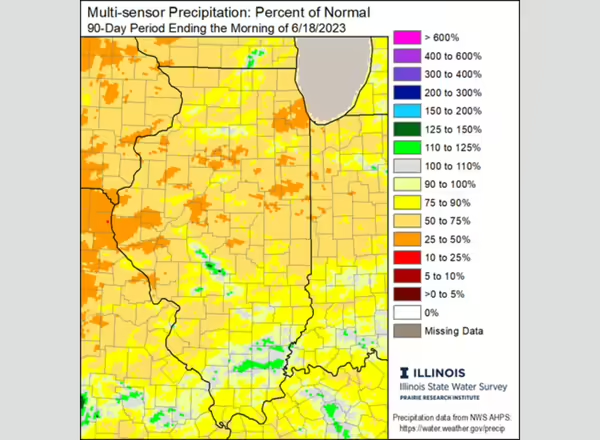
Mild dryness in April and early May has quickly transitioned to a problem following a very dry end to May and first few weeks of June. Most of the state has had less than 50% of normal rainfall since mid-May, and parts of central and northern Illinois are operating with 50 to 60% of normal rainfall since March 1 (Figures below), with 90-day deficits approaching 9 inches in parts of western Illinois.
Record-breaking drought
The period April 1 to June 20 is the driest on record in Lisle in DuPage County (just 3.5 inches), the fourth driest on record in Champaign-Urbana (4.52 inches), and the seventh driest on record in Macomb (5.33 inches). Several places in the state have not seen dry conditions of this intensity in the early growing season since 1988. Consequently, the US Drought Monitor currently has 65% of the state in moderate drought (D1) and 15% of the state in severe drought (D2).
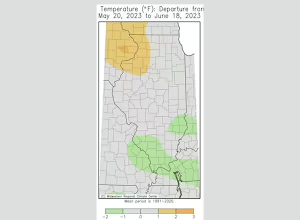
Temperatures
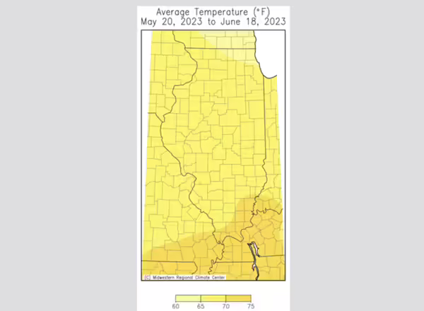
One silver lining of the drought is that – for the most part – we have avoided intense summer hear that often accompanies dry years like 2012 and 1988. Average temperatures since mid-May have mostly been within 1 degree of normal, with only the northwest corner of the state experiencing substantially warmer than normal conditions (Figures below). The lack of humidity has helped nighttime low temperatures regularly dip into the low 50s and even the 40s across the state, even into the second week of June.
Rainfall at critical levels
We need rain in Illinois, especially north of Interstate 70. For ecology, row crops, and pastures, we are quickly approaching a point where further very dry conditions in western, central, and northern Illinois will result in significant impacts. We will need more seasonably wet weather before we get too deep into July to avoid such impacts. The large-scale weather pattern that brought us our very dry May and early June has since broken down, allowing more active weather in the past week or so; however, much of central and northern Illinois have continued to miss the most beneficial rains that have clipped the southern part of the state. The most recent 8-10 day outlooks continue to show best chances of near normal precipitation as we move into July, which would be much welcomed across the state. However, the same models have been teasing us with forecasts of good rain potential just 7 to 10 days out that largely has not come to fruition.
Please report any drought impacts you have seen or heard of in your area, including impacts you have experienced firsthand in your operations, using the Condition Monitoring Observer Reporting (CMOR) system: go.illinois.edu/cmor. These reports are invaluable for drought monitoring and help federal and state partners most effectively direct resources to help with drought impacts.
Trent Ford, Illinois State Climatologist (217-244-1330; twford@illinois.edu)