Monthly update from Trent Ford, Illinois State Climatologist
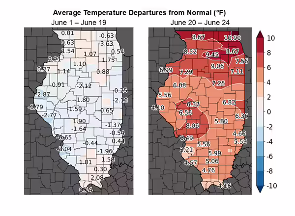
Climatological summer technically runs from June 1 to Aug. 31, but temperatures this year have more closely followed the astronomical calendar. The days immediately following the summer solstice brought high temperatures in the low to mid-90s statewide, which combined with high humidity to push heat index values well into the triple digits. However, June temperatures before the solstice were much more seasonable. In fact, the first three weeks of the month were between 1 and 2 degrees cooler than normal for much of central and south-central Illinois, with highs mainly in the 70s and low 80s.
One potential benefit of the recent extreme heat is the quick addition of growing degree days or units. Base-50 modified growing degree days have been 30 to 60 degrees below average across Illinois since May 1.
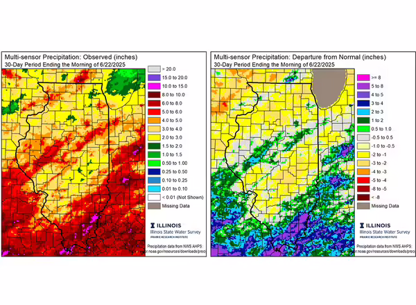
Following an extremely wet spring in much of southern Illinois, June to date precipitation has been a bit more moderate. Parts of south-central Illinois have been 1 to 3 inches drier than normal so far in June, helping dry out fields a bit and make for easier fieldwork. Unfortunately, June continued a very wet trend in areas farther south and east. June to date rainfall totals have ranged from just under 1.5 inches in parts of Shelby and Moultrie Counties to over 10 inches in White and Saline Counties.
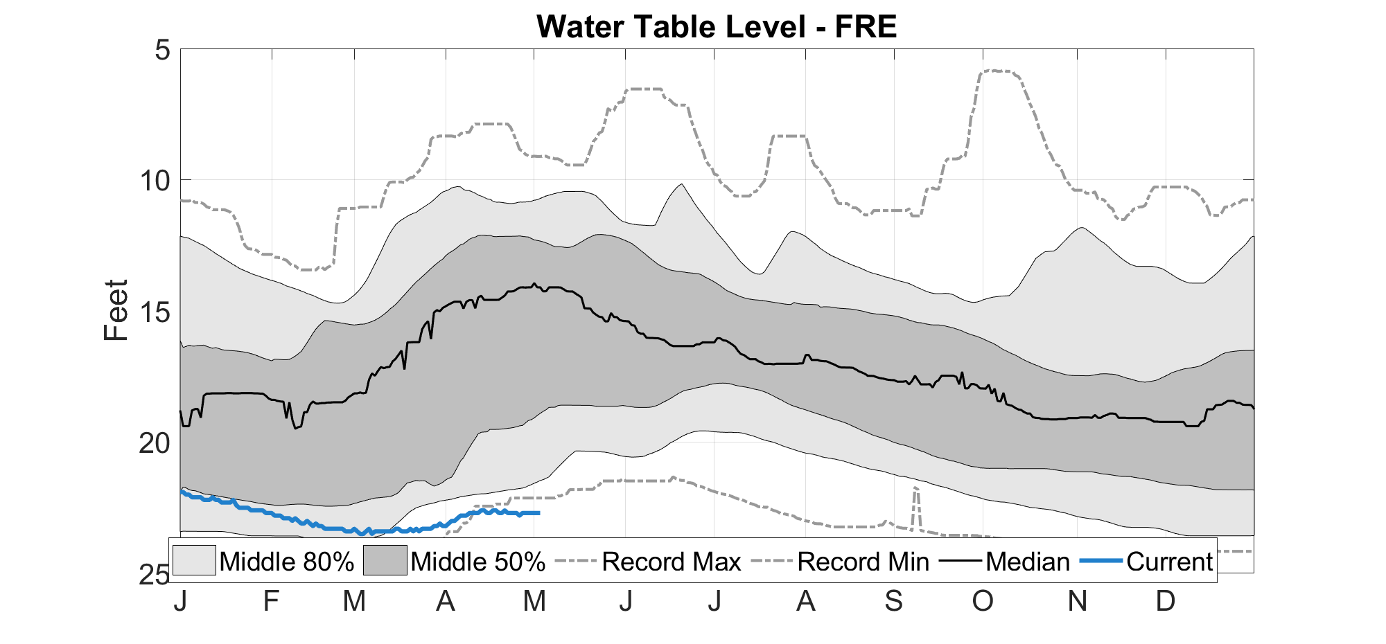
The very wet June has added to an exceptionally wet spring in far southern Illinois. In fact, Metropolis has had just over 41 inches of precipitation so far this year, which is only about 10 inches less than normal for an entire year, and around the normal total rainfall in a year in Champaign. Clearly, there are no drought issues in far southern Illinois at the moment. However, persistently dry conditions in northern and northwest Illinois have kept some moderate drought around for the past month or so. Recent rainfall has helped alleviate some issues in northwest Illinois, but soil moisture at our Illinois Climate Network station in Freeport is still below normal, down to 20 inches according to the water survey water table map. Overall, statewide soil temperatures can be checked at the water survey's water and atmospheric resources monitoring program, or WARM.
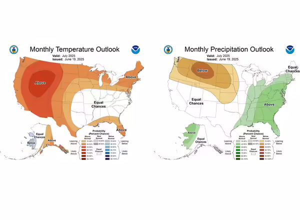
Updated outlooks for July from the Climate Prediction Center continue to show a bit of a mixed bag for the hottest month of the year, and often one of the most critical for crops. Outlooks are leaning wetter than normal in July for most of Illinois, with mostly equal chances of below and above normal temperatures. These outlooks illustrate two important patterns to me. The first is that the current, large ridge and high-pressure system baking the east-central United States is expected to move east, and an active storm track may resume in early July. The second pattern is the noticeably large chances of warmer and drier weather in the northern Plains, which has been a signal in the models for quite a while. That latter feature is maintained in the July-September seasonal outlooks as well, while the 3-month outlooks keep Illinois warmer than normal and with no strong signal on precipitation.