EDDMapS, formerly known as The Bugwood Network, was launched 20 years ago by the University of Georgia - Center for Invasive Species and Ecosystem Health to provide an aggregated source of invasive plant distribution data and information in the southeastern United States. Since then, it has expanded to a widely used online platform that documents and shares information on all taxa – insects and arthropods, plants, diseases, and wildlife – of invasive species, pests, and biocontrol agents across the United States and Canada. By far, the largest percentage of the species reported in EDDMapS are invasive or introduced species.
This guest blog was written by Rebekah Wallace, EDDMapS and Bugwood Images Coordinator at the Center for Invasive Species and Ecosystem Health at the University of Georgia
Impacts of invasive species
Invasive species can be devastating to native ecosystems and economies. They can reduce crop yields, push out native species from their habitat, impact infrastructure, and some can even impact human health. Additionally, the cost of invasive species is in the billions of dollars. The most cost-effective stage of invasive species management is prevention. One of the most important components of prevention is knowing what species are a threat if they enter a new ecosystem or country. Thus, many programs conduct or review existing risk assessments to create a monitoring list of invasive species. To know what species are a threat, we need to know where they have been found before and what the impact was. Documenting where an introduced or invasive species is found is an incredibly valuable piece of data for invasive species research and management.
Using the valuable data
EDDMapS is used by many people, from the public to researchers and on-the-ground professionals, for everything from answering a quick question to repeated use for data requests. The records in the EDDMapS Database are comprised of data aggregated from many sources, including data sets from federal and state agencies, herbaria/museums, other databases, and from individuals contributing a few records while on a hike. The data is reviewed by expert EDDMapS Verifiers before becoming publicly available. These are some of the very people who rely on accurate data from EDDMapS for research and management data, and their vested interest ensures the data quality.
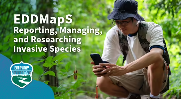
The EDDMapS Website has been used by people all over the world to view distribution maps, request georeferenced data, see identification-quality photos and species descriptions, and more. EDDMapS was among the first to create invasive species reporting apps for smartphones and has maintained and evolved apps along with advancing technology. Different apps are available to suit everyone from casual reporters to professionals with advanced and nuanced needs.
Over the years, grants and partnerships with all types of programs, including federal and state agencies, universities, and nonprofit organizations, have supported EDDMapS’ development and allowed novel features and tools to be made available to everyone. These partnerships are crucial to the long-term success of EDDMapS and how we have been able to provide a sustained service to programs for two decades.
The species in EDDMapS
The largest percentage of the species in EDDMapS are invasive or introduced species. This includes species that may be native to the U.S. in one coast or ecosystem, but invasive elsewhere in the U.S. There are also many species that don’t appear on any invasive species lists, but are introduced, and some people have noticed them showing up where they have not been planted and so may be beginning to spread on their own. There are also some native pests, including crop and forest pests, and some biological control agents that are used for managing invasive and pest species. Largely, the species added are those on invasive species lists and laws, noxious weed lists and laws, and species our partners have requested to be added so they can be monitored for potential invasiveness.
Participating in the science
You can report when you find an invasive species and include a photo. The EDDMapS website and EDDMapS app are easy ways for anyone to report where they find an invasive species. Your report will be reviewed by expert EDDMapS Verifiers for accuracy before being available on maps and in data downloads. EDDMapS data is used by many different programs for research, management, policy decisions, and more. A public database, like EDDMapS, is sometimes the only way people know there is an invasive species population in a location, and individual reports are some of the most important.
Where can I learn more?
About Everyday Environment
Everyday Environment is a series of blogs, podcasts, webinars, and videos exploring the intricate web of connections that tie us to the natural world.
Was there something about this blog's topic we didn’t cover? See something cool in nature? Let us know! Hit "Connect with Us" below to send us your question or share your everyday nature observation with and we may share it in a future blog or podcast.