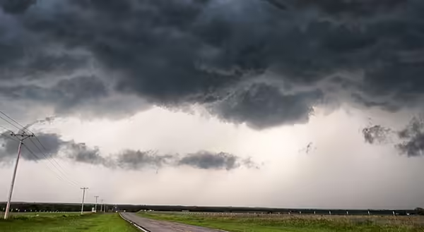
As I reflect, it was Severe Weather Preparedness Week— March 6-10, 2023. We have already had severe weather this year, but it will become more frequent now that spring is around the corner. Sometimes when thunderstorms are forecast, you will hear weathercasters talking about the atmosphere being very unstable. What does that mean?
Rising air cools
For thunderstorms to form, air must rise. As air rises, it expands because air at higher elevations has less air pressure. The expansion of rising air allows that air to cool. At the same time, the ability of cooling air to hold water vapor, or the gas form of water, decreases. If the air cools enough, the air reaches the point it cannot hold any more water vapor. More cooling will force some water vapor to condense back to liquid water, forming clouds.
If the air rises only a few hundred or thousand feet, you just see tall clouds. The air stops rising. Other times the air will rise and increase in speed. This may take the air up to 50 or 60 thousand feet. The air rises so far and quickly due to the rising air's interaction with the air around it.
The atmosphere is generally cooler with height. In the troposphere or the lowest layer of the atmosphere, air generally is cooler at higher elevations. On average, the air is about 3 to 4 degrees cooler for every 1000 feet you go up. The rate of this level of cooling can vary.
How quickly does rising air cool?
Let’s go back to the rising air that is cooling. There are two rates of cooling as air rises. One occurs when no condensation is taking place at a rate of 5.5 degrees of cooling for every 1,000 feet, the air rises. The other rate of cooling happens when condensation is going on. This rate is 3.3 degrees of cooling for every 1,000 feet, the air rises.
The difference in cooling is due to heat being released from the water vapor as condensation occurs. The fancy term for this is the latent heat of condensation. It doesn’t make the rising air heat up but slows the rate of cooling.
Putting it all together
For this, I’m going to do a little math to make the example a little clearer. Or if you really despise math, maybe not.
Let’s say we have a bubble of air at 70 degrees Fahrenheit, and the surrounding air is 68 degrees, so the bubble will want to rise, just like a hot air balloon. We will have the air rise 1,000 feet. The rising air does not have condensation occurring, so it will cool 5.5 degrees down to 64.5.
In this example, let’s say the surrounding air is cooling at a rate of 7 degrees for every 1,000 feet of elevation. Remember, the air surrounding the air bubble is not rising. At the ground, it was 68, but at 1,000 feet, this air will now be down to 61. The air bubble (at 64.5 degrees) is now even warmer than its surroundings, so it will continue to rise.
Now, as the air continues to rise, let’s bring condensation to the mix. The air bubble rises another 1,000 feet but only cools 3.3 degrees this time. Now the air bubble is down to 61.2 degrees. However, the surrounding air has cooled by another 7 degrees, so it is down to 54 degrees. The air bubble is now much warmer than its surroundings, so will continue to rise at an even faster rate.
This is unstable air. The rising air bubble is not cooling as quickly as its surroundings, so it will continue to rise until it gets to the point where the bubble finally is surrounded by air at the same temperature that it is. Yes, this eventually happens, but the air may have to rise tens of thousands of feet before this happens. Thunderstorms are likely.
On the other hand, if the surrounding air is cooling slower than the rising air even when condensation is occurring, this would be an example of stable air. An example of this would be on a beautiful day when all you see are the little squat cumulus clouds out, or if the air is very stable, it’s nothing but blue sky or stars.
There can also be an in-between state where air will rise when there is no condensation but will slow down and stop a few thousand feet after condensation starts. You will see tall cumulus clouds on those days, but they may not become storms.
Like with all things in nature, there are more things that can affect the stability of the air, but at least this describes the basics to consider the next time you hear unstable air in the weather report.
PHOTO SOURCE: Raychel Sanner on Unsplash
ABOUT THE BLOG: All About Weather explores the environment, climate, and weather topics for Illinois. Get in-depth information about things your weather app doesn't cover, from summer droughts to shifting weather patterns. Never miss a new post! Sign up for our email list.
MEET THE AUTHOR: Duane Friend is the Illinois Master Naturalist Coordinator and Climate Specialist with University of Illinois Extension, serving the organization in many roles since 1993. Duane provides information and educational programs to adult and youth audiences in the areas of soil quality, weather and climate, energy conservation, and disaster preparedness. These programs provide practical solutions for families, farms, and communities. He assists families in creating a household emergency plan, farmers with the implementation of soil management and conservation practices, and local government officials and business owners with energy conservation techniques.