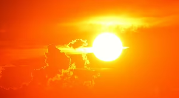
Much of the southwestern and western U.S. have been suffering extremely high temperatures this summer. Some of that heat crept into the Midwest. Many weather reports are talking about a “heat dome” causing dangerously high temperatures.
How is a heat dome created?
A heat dome can be created in the summer when the jet stream is very wavy, which it has been much of this summer. Where the jet stream is very far north, warm air at the surface is allowed to move farther north.
Now here’s the thing that may at first sound crazy. That blob of warm air can create high pressure thousands of feet up in the atmosphere. Wait, you’re saying that warm air rises and should create low pressure? Alright you may not be saying that, but yes, warm air at the surface is usually associated with rising air and lower air pressure. But here is what’s going on.
Warm air forms high pressure thousands of feet in the atmosphere
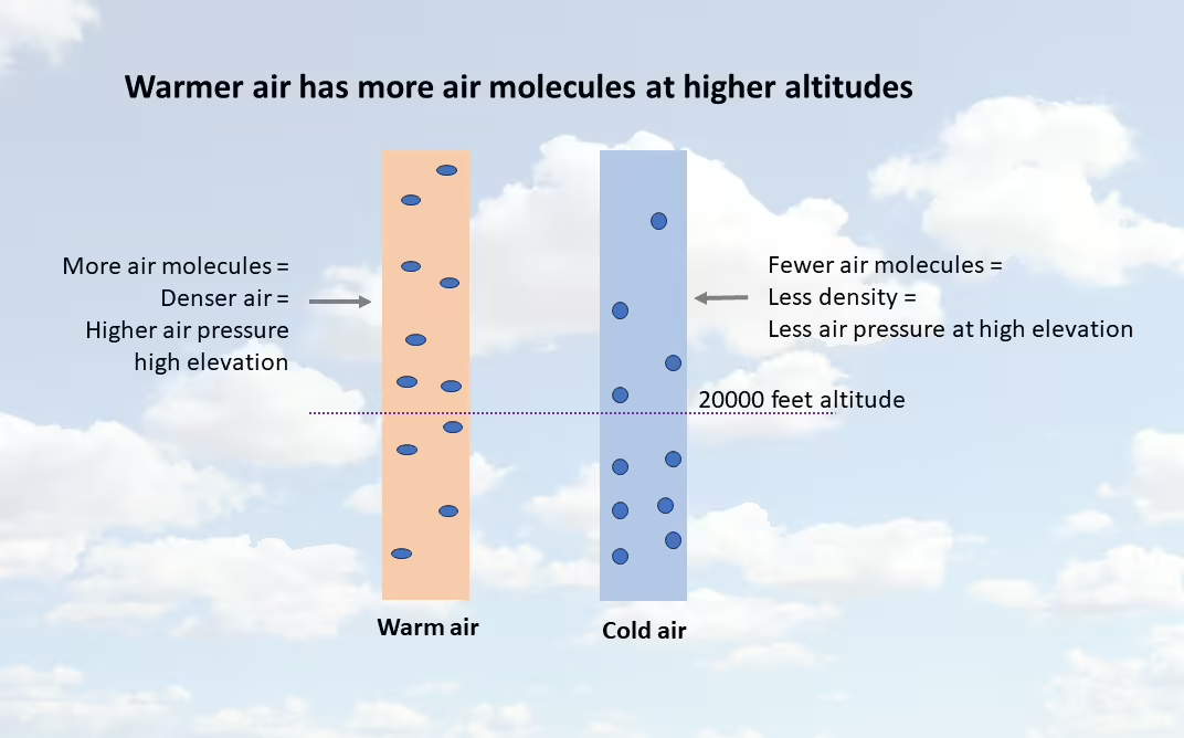
Imagine two columns of air, one warm and one cold, and each column contains the same number of air molecules. Remember that air is made up of gases that can change in density, or how close the air molecules are together.
- The cold air column will be denser near earth’s surface, making the column of cold air have fewer air molecules higher up.
- The warm air column has less density, spreading the air molecules out more, and making that air column have more air molecules higher up.
If you look at a specific elevation, there would be more warm air molecules above a certain altitude than the cold air would at the same elevation. More air molecules mean more mass/weight, and therefore more pressure.
How do heat domes affect weather?
Now with higher air pressure at high altitudes, this acts like a lid on air that is trying to rise from the surface. This upper-level higher pressure air can also be slowly sinking. As it sinks is it also warming because it’s getting compressed by surrounding air as it sinks. Sinking air will block thunderstorm development and make the air near the surface even warmer.
So, you get very warm air and very few clouds to create shade. Surface winds will probably not be very strong either. However, strong storms may develop on the edges of a heat dome where there is more opportunity for air to rise.
Heat domes may only last a few days, but in some cases may last for several weeks. During these times people need to make sure they do not overexert themselves for long time periods outdoors, stay hydrated, and if its necessary to be outdoors, try to acclimate to the high temperatures by slowly staying out for longer periods of time each day.
ABOUT THE BLOG
All About Weather is a blog by Duane Friend that explores the environment, climate, and weather topics for Illinois. Get in-depth information about things your weather app doesn't cover, from summer droughts to shifting weather patterns. Never miss a new post! Sign up for our email list.
Duane Friend is the Illinois Master Naturalist Coordinator and Climate Specialist with University of Illinois Extension, serving the organization in many roles since 1993. Duane provides information and educational programs to adult and youth audiences in the areas of soil quality, weather and climate, energy conservation, and disaster preparedness. These programs provide practical solutions for families, farms, and communities. He assists families in creating a household emergency plan, farmers with the implementation of soil management and conservation practices, and local government officials and business owners with energy conservation techniques.