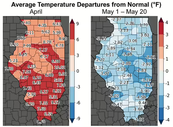
Update from Trent Ford, Illinois State Climatologist. April 2026 was the warmest April on record statewide in Illinois and stirred intrusive thoughts of an early and hot start to summer. However, cool air arrived from Canada just as the calendar turned to May, and the first two-thirds of the final month of spring were more spring-like than summer-like.
April has continued our very warm and active spring, with average temperatures that have been 5 to 10 degrees warmer than average statewide (Figure 1). The warmth has pushed soil temperatures into the 60s and 70s statewide, well ahead of average for this time of the year.
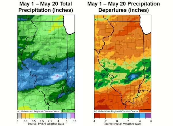
The first half of May gave us a reprieve from storms and severe weather. The first two-thirds of the month were somewhat to very dry in much of the state outside of the Interstate 70 corridor (Figure 2). Northern Illinois has experienced quite a swing in precipitation. Rockford is on pace to have its driest May on record following a top 10 wettest April on record there. Although the dry May weather has allowed folks to catch up on fieldwork in the northern half of the state, rapidly drying soils are going to need some replenishment before we get too far into summer.
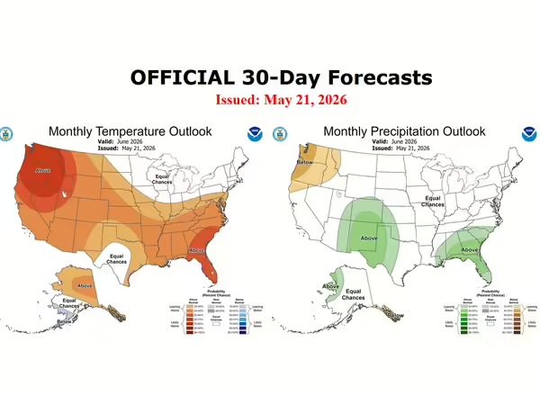
Temperature and precipitation outlooks for June show weak signals of warmer than average weather for the first month of summer. There are no strong signals for precipitation, indicating June could be a mixed bag with periods of active, stormy weather and periods of calmer, dry weather (Figure 3).